The Pacific Marine Environmental Laboratory (PMEL) is a federal research facility operated by NOAA that sends scientists on ocean expeditions worldwide to study climate, ecosystems, and ocean chemistry, and you can bring this real-world research directly into your classroom through accessible data, visualizations, and educational resources designed for K-12 learners.
For educators looking to connect students with authentic marine science, PMEL offers something rare: access to the same data and tools professional oceanographers use, translated into formats that work for young learners. When PMEL scientists deploy underwater robots to track acidification in the Pacific or install buoys to monitor tsunami threats, they’re gathering information your students can explore through interactive maps, live data feeds, and expedition journals that document discoveries as they happen.
This combination of cutting-edge research and educational accessibility makes PMEL particularly valuable for teaching marine ecology. Students don’t just read about ocean science; they engage with current measurements, track ongoing expeditions, and see how scientists form questions, collect evidence, and draw conclusions in real time. The laboratory’s work spans everything from deep-sea vents to coral reef monitoring, giving you flexibility to match content with your curriculum goals while showing students that ocean research is active, evolving, and directly relevant to understanding environmental change in 2026.
What the Pacific Marine Environmental Laboratory Does
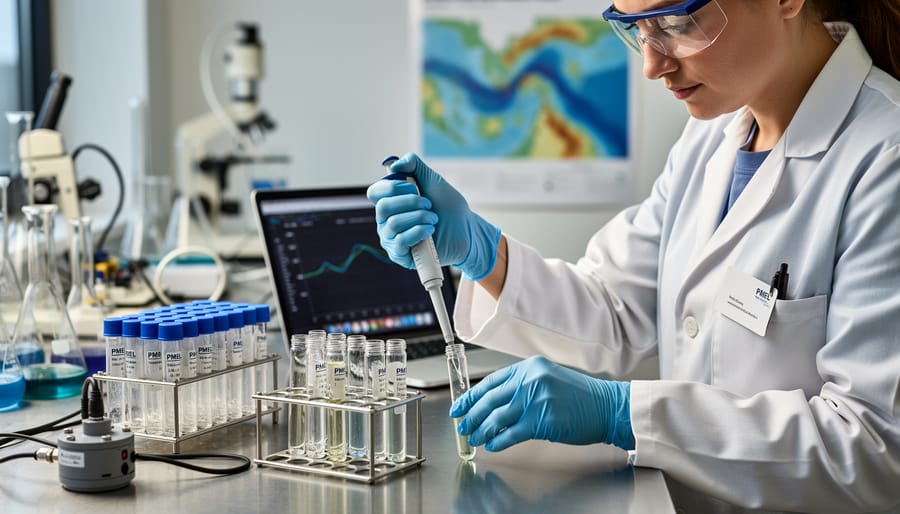
The Pacific Marine Environmental Laboratory operates as a research division within the National Oceanic and Atmospheric Administration, conducting expeditions and long-term monitoring projects across the world’s oceans. Based in Seattle, Washington, PMEL scientists deploy advanced technology to study ocean systems that directly affect weather patterns, coastal safety, and marine life. The lab’s work provides the data and discoveries that help us understand how oceans regulate climate, sustain ecosystems, and respond to human activity.
PMEL’s research spans several interconnected areas that educators can bring into classroom discussions:
- Climate science: tracking ocean heat content, currents, and the ocean’s role in regulating global temperatures
- Ocean acidification: measuring how increased carbon dioxide absorption changes seawater chemistry and affects marine organisms
- Tsunami detection: operating early warning systems through deep-ocean sensors that save lives in coastal communities
- Underwater volcanoes and hydrothermal vents: exploring seafloor geology and the unique ecosystems thriving in extreme conditions
- Ecosystem monitoring: observing fish populations, coral reefs, and marine habitats to understand environmental changes over time
Each research focus connects to real-world challenges students hear about in news reports and environmental discussions. When PMEL scientists deploy instruments from research vessels or analyze data from autonomous floats drifting thousands of miles, they gather evidence that helps predict El Niño events, track ocean warming, and protect communities from natural hazards.
The lab collaborates with universities, international research institutions, and other NOAA offices to maintain networks of sensors across the Pacific, Atlantic, and Arctic oceans. This global approach means PMEL’s datasets capture ocean conditions at scales impossible for any single institution to achieve alone. For educators, this translates into access to authentic scientific information collected through the same methods professional oceanographers use during marine ecology expeditions.
How PMEL Conducts Marine Research Expeditions
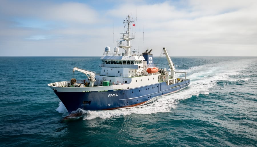
PMEL expeditions combine cutting-edge technology with careful planning to study ocean environments that are difficult or impossible to observe any other way. Scientists aboard research vessels like the NOAA Ship Ronald H. Brown spend weeks at sea collecting measurements from surface waters down to the deep ocean floor. These voyages follow specific routes designed to track phenomena such as El Niño cycles, volcanic activity along underwater ridges, or changes in ocean chemistry that affect marine life.
The lab relies on multiple tools working together. Autonomous underwater vehicles, or AUVs, can dive to extreme depths and navigate independently while mapping seafloor features or measuring water properties. Gliders move through the water column for months at a time, surfacing periodically to transmit data on temperature, salinity, and ocean currents. Deep-sea moorings anchored to the bottom hold instruments that record conditions continuously, even in storms or rough seas when ships can’t operate.
Remote sensing from satellites adds another layer. Scientists compare satellite observations of sea surface temperature or chlorophyll levels with measurements taken directly from the water, creating a fuller picture of ocean dynamics across vast areas.
Data from these expeditions reveals patterns educators can bring into the classroom. PMEL teams have documented how warming waters shift fish populations, tracked the spread of acidified zones that threaten shellfish, and monitored underwater volcanoes that reshape ecosystems without warning. During expeditions to hydrothermal vents, researchers discovered new species thriving in extreme conditions, showing students that ocean exploration still yields genuine surprises.
This multi-tool approach means PMEL can monitor both immediate events, like tsunami waves crossing the Pacific, and slow changes unfolding over decades, such as rising ocean heat content. Each expedition adds pieces to the larger puzzle of how our ocean works.
Bringing PMEL Science Into Your Classroom
Free Educational Resources from PMEL
PMEL makes ocean science data and expedition materials directly accessible to teachers at no cost. Their website hosts interactive ocean visualizations showing real-time data from buoys, drifters, and underwater sensors. Teachers can access charts tracking ocean temperature, carbon levels, and tsunami warnings, all pulled from actual research instruments deployed worldwide.
The lab’s expedition logs document research cruises in detail. These include ship routes, daily science activities, and photographs from the field. Elementary teachers can use expedition stories and images to introduce ocean careers and scientific exploration. Middle school classes can analyze data tables and graphs showing how scientists measure change over time. High school students can work with raw datasets to investigate patterns in ocean chemistry or climate trends.
PMEL’s multimedia collection includes videos of underwater volcanic eruptions, deep-sea research vehicles in action, and scientists explaining their work. These short clips bring remote ocean environments into the classroom without requiring specialized equipment.
For direct curriculum support, PMEL offers downloadable lesson plans aligned with standards in earth science, environmental science, and data literacy. Materials explain complex topics like ocean acidification and El Niño using clear diagrams and simplified language suitable for younger learners, with more technical content available for advanced high school courses. All resources update regularly as new expeditions generate fresh data.
Connecting Students with Real Ocean Science
PMEL expedition data opens the door to hands-on activities that mirror how scientists actually work. Students can track real-time ocean temperature shifts using PMEL’s buoy networks, comparing current readings to historical data to identify patterns. Have them map carbon dioxide levels across different ocean regions, then discuss what rising acidity means for shellfish and coral reefs.
Turn expedition logs into detective work: share a PMEL cruise diary and ask students to identify the research question, methods used, and findings. They can analyze seafloor mapping images to spot underwater volcanic features or use tsunami buoy data to understand early warning systems.
Integrate these experiences with real field research principles by having students maintain ocean data journals where they record observations, sketch visualizations, and formulate questions like working oceanographers. These living laboratory projects connect students to ongoing scientific investigations, showing them that ocean science happens now, with implications they can measure and explore themselves.
Why Marine Ecology Expeditions Matter for Student Learning
Watching actual scientists explore uncharted seafloor or measure ocean acidification in real time transforms abstract concepts into immediate, compelling questions for students. Marine ecology expeditions like those conducted by PMEL give learners something textbooks alone cannot: the messy, uncertain, exciting process of discovery as it unfolds.
This exposure to authentic research builds critical thinking in ways classroom simulations rarely match. Students see how scientists form hypotheses, adjust methods when equipment fails, and interpret incomplete data. They learn that science is not a collection of settled facts but an ongoing conversation with the natural world, where answers lead to new questions and uncertainty drives progress.
Real expedition data also grounds abstract environmental concerns in observable reality. When students track changes in sea surface temperatures or examine dissolved oxygen levels from PMEL moorings, climate change stops being a distant prediction and becomes a measurable phenomenon with documented impacts. This concrete connection helps learners understand environmental stewardship not as a vague responsibility but as an informed response to specific, quantifiable challenges.
For STEM learning goals, expeditions integrate multiple disciplines naturally. A single research voyage involves mathematics for data analysis, engineering for instrument design, biology for ecosystem observations, and technology for remote sensing. Students see these fields working together to solve complex problems, reinforcing that real science rarely fits into neat subject categories.
Perhaps most importantly, following marine research helps students connect with science as a human endeavor. They encounter researchers facing setbacks, celebrating breakthroughs, and collaborating across institutions and borders to understand our changing oceans.
Common Questions About PMEL and Marine Research in Education
Educators often have practical questions about incorporating PMEL’s work into their teaching. The lab’s focus on cutting-edge ocean science can feel distant from the classroom at first, but many of these concerns have straightforward answers that make real-world marine research surprisingly accessible for K-12 settings.
Do I need specialized equipment to use PMEL data with my students?
No. PMEL provides data visualizations, interactive maps, and downloadable datasets that work with standard classroom computers and free software. Most resources are browser-based and require no special tools.
How do I align PMEL resources with my curriculum standards?
PMEL materials support Next Generation Science Standards and state frameworks in Earth science, life science, and environmental literacy. Focus on expedition stories for younger students and raw data analysis for high schoolers to match developmental levels.
Are these resources appropriate for elementary students?
Yes. Use PMEL’s expedition logs, photos, and videos to introduce ocean science concepts through storytelling. Elementary students connect well with the human side of research expeditions and visible discoveries like underwater volcanoes or unique marine life.
How can I keep students engaged with complex ocean science topics?
Start with a compelling question or recent discovery from a PMEL expedition, then let students explore the data behind it. Real scientific mysteries and ongoing research create natural curiosity that abstract lessons often miss.
Technical background varies widely among educators, and that should not be a barrier. PMEL’s educational materials include explanatory guides that break down scientific terminology and research methods in plain language. If a dataset seems too advanced, look for the associated expedition narrative or summary report, which typically presents findings in more accessible formats. Many teachers find success by having students work in small groups to interpret data together, turning complexity into a collaborative challenge rather than an individual hurdle. The key is matching the resource to your students’ current skills while stretching them just enough to build confidence with authentic scientific work.